Piscataquis County (pop. 17,535) is the least populous county in Maine, and the second-largest in square miles. The county reached its peak population of 20,554 in 1920. It is pronounced “Pis-KAT-uh-kwis.”

Piscataquis County in 1895
“Piscataquis” is an Abenaki word meaning “branch of the river.” The 65-mile Piscataquis River is a major tributary of the Penobscot River.

It flows through the southern part of the county.
Piscataquis County has been called the most rural county in the most rural state in the U.S. The county is mostly unsettled wilderness, with much land traditionally owned by the timber industry.

Most of the population is in the county’s southernmost part.
The county seat is Dover-Foxcroft (pop. 4,213). The two communities, located on opposite sides of the Piscataquis River, merged in 1922.

It is also the county’s largest town.
Northwest of Dover-Foxcroft is the town of Monson (pop. 686), a major resting point on the 2,200-mile Appalachian Trail.

The trail goes from Georgia to Maine.
Monson is the last town before the trail goes east into the “Hundred-Mile Wilderness,” which is often considered the wildest area of the trail.

The Appalachian Trail ends on Mount Katahdin (elev. 5,269), the highest point in Maine.
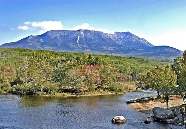
The mountain is in Baxter State Park.
Baxter State Park is unusual in several ways: it has no electricity, running water, or paved roads, and it’s not actually part of the Maine State Park System.

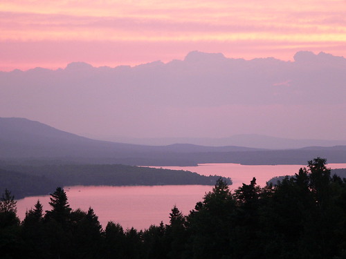
Piscataquis County has many large lakes and reservoirs, with abundant fishing. Moosehead Lake is the largest mountain lake in the eastern U.S.
The source of the Kennebec River
NEXT: SOMERSET COUNTY