Wyoming: Park County

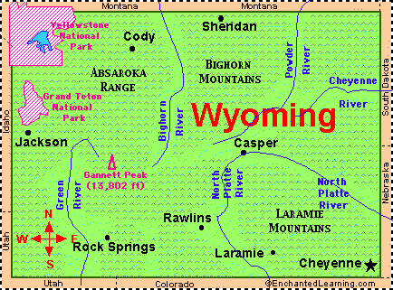
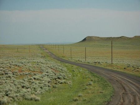
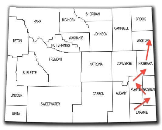
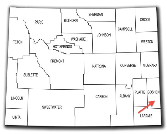
Park County (pop. 28,205) is in the northwestern corner of Wyoming. It is one of three Park counties in the U.S.

Wyoming’s fourth-largest county in square miles

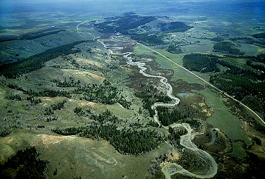
Park County was named for Yellowstone National Park; more than half of the park is in the county.

Grand Canyon of the Yellowstone

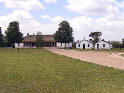
Mammoth Hot Springs is in the northern part of the county, near the Montana border.

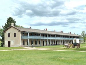
Adjacent to Fort Yellowstone

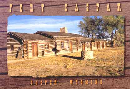
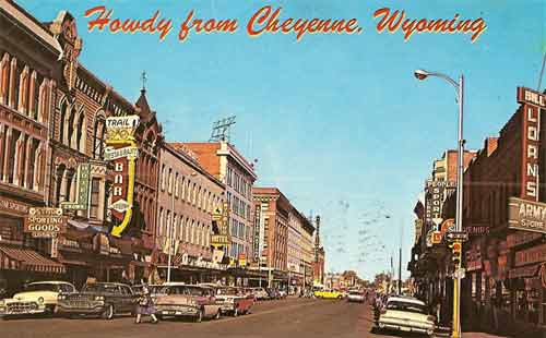
The county seat of Park County is Cody (pop. 9,520), which was named for William “Buffalo Bill” Cody – one of the founders of the town. Cody is about 50 miles east of Yellowstone Park.

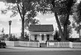
Born in 1846 in LeClaire, Iowa

Buffalo Bill’s boyhood home (moved from Iowa to Cody) is part of the Buffalo Bill Center of the West.

It was moved in 1933.

Cody also has a dam named for Buffalo Bill (on the Shoshone River) and a prominent statue of Buffalo Bill.

Another statue in Cody recognizes the mountain man named John “Liver-Eating” Johnson.
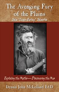
Buy the book!

The artist Jackson Pollock was born in Cody in 1912.

A painting by “Jack the Dripper”

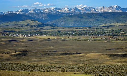
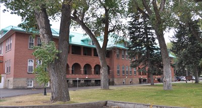
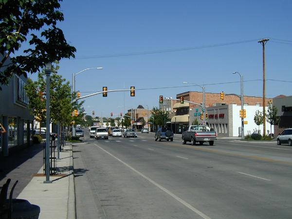
The town of Powell, about 25 miles northeast of Cody, is the home of the two-year Northwest College.

Founded in 1946

NEXT STATE: MAINE (Coming soon)

Wyoming: Teton County

Teton County (pop. 21,294) is north of Sublette County. It was named for the Teton Range, which runs north-south through the western part of the county.

Grand Teton National Park

All of Grand Teton National Park and 40 percent of Yellowstone National Park are in Teton County.

Teton County is the wealthiest county in Wyoming in per-capita income and one of the wealthiest counties in the U.S.

Jackson Hole Airport is the busiest in the state.

The valley known as Jackson Hole has the Teton Range on the west and the Gros Ventre Range on the east, with the Snake River running through it from north to south.

River-rafting on the Snake

At the southern end of Jackson Hole is Jackson (pop. 9,577), the county seat.

Jackson has several ski resorts nearby, including Jackson Hole Mountain Resort and Snow King Mountain.

The Tram at Jackson Hole Mountain Resort

George Washington Memorial Park in downtown Jackson is known for its elk antler arches.

Four of them

Just northeast of Jackson is the National Elk Refuge, which was created in 1912 to protect the largest elk herd in the country.

Winter home of about 7,500 elk

The part of Yellowstone National Park within Teton County includes Yellowstone Lake and Old Faithful Geyser.

Interior of Old Faithful Inn (1904)

NEXT: PARK COUNTY

wyoming map - working

Wyoming: Sublette County

Sublette County (pop. 10,247) is northeast of Lincoln County. It was named for William L. Sublette, an early fur trader in Wyoming.

The Wind River Range has 19 of Wyoming’s 20 tallest peaks, and many of them are along the Continental Divide in the northeastern part of Sublette County.

Three national forests are in the county.

The Green River has its source in Sublette County; the river then flows south from the Wind River Range on its way to join the Colorado River in southeastern Utah.

The county seat of Sublette County is Pinedale (pop. 2,030), at an elevation of 7,182 feet.

Pinedale and the Wind River Range

Pinedale is the home of the Museum of the Mountain Man. From 1825 to 1840, trappers and traders had an annual spring rendezvous in the area.

The Log Cabin Motel in Pinedale dates from 1929.

On the National Register of Historic Places

The Church of St. Hubert the Hunter (Episcopal) was built in the community of Bondurant (pop. now 93) in 1940 with the $1,400 proceeds from the sale of a donated diamond.

Built of logs

Big Piney (pop. 552, elev. 6,824) is one of several towns claiming to be the “Ice Box of the Nation.” (International Falls, Minnesota, is another.)

NEXT: TETON COUNTY

wyoming map - working

Wyoming: Lincoln County

Lincoln County (pop. 18,106) is one of 23 Lincoln counties in the U.S. Not only is it adjacent to Idaho – it is shaped like Idaho.

It also borders Utah.

The county seat of Lincoln County is Kemmerer (pop. 2,656).

Lincoln County Courthouse (1925)

James Cash Penney (1875-1971) opened his first store in 1902 in Kemmerer. Penney’s stores were originally called Golden Rule Stores.

The “Mother Store” in Kemmerer is still in business.

Penney’s house in Kemmerer is open for tours.

A National Historic Landmark

About 15 miles west of Kemmerer is Fossil Butte National Monument. The visitor center has a variety of fossils and fossil casts.

Established in 1972

In the northwestern part of Lincoln County is the Star Valley, surrounded by mountains and forests.

It runs north-south, adjacent to the Idaho border.

The largest city in the valley is Afton (pop. 1,911), the hometown of Olympic wrestler Rulon Gardner.

Greco-Roman gold medalist in 2000

Downtown Afton has a 75-foot arch over U.S. Highway 89. The arch is made entirely of elk antlers.

The largest of its kind

NEXT: SUBLETTE COUNTY

wyoming map - working

Wyoming: Uinta County

Uinta County (pop. 21,118), in the state’s southwestern corner, is Wyoming’s second-smallest county in square miles.

The county is named for the Uinta Mountains, which are visible across the Utah state line to the south.

The highest east-west range in the 48 contiguous states

The county seat is Evanston (pop. 12,359). Its population grew from about 6,000 in 1980, thanks to the oil and natural gas in the region.

Old Post Office (1905)

Evanston has the oldest courthouse in the state. It was built in 1873-74 and expanded in 1910.

Uinta County Courthouse

The Union Pacific roundhouse (1912-13) and other historic structures are still standing in the Union Pacific Railroad Complex in Evanston.

Evanston was founded along the first transcontinental railroad.

The Wyoming State Hospital (formerly the Wyoming State Insane Asylum) is in Evanston.

The historic buildings date from the early 20th century.

Bear River State Park is just east of Evanston. The 491-mile Bear River is the largest river that flows into the Great Salt Lake.

The longest U.S river that does not reach an ocean

Farther east on Interstate 80 is Fort Bridger State Historic Site. It was a 19th-century fur trading post, supply point for wagon trains, and military post.

Established by mountain man Jim Bridger

NEXT: LINCOLN COUNTY

wyoming map - working

Wyoming: Sweetwater County

Sweetwater County (pop. 43,806) is Wyoming’s largest county in square miles. It is the eighth-largest county in the U.S. and is larger than six different states.

Named for the Sweetwater River, which is not in the county

Interstate 80, which runs from California to New Jersey, goes through the middle of Sweetwater County – following the route of the Overland Trail and the Lincoln Highway.

I-80 tunnels near Green River

The county seat of Sweetwater County is Green River (pop. 12,515), located in an area that is now booming with natural gas and oil shale production.

Green River and Castle Rock

The Green River Ordinance, a city ordinance that prohibits door-to-door solicitation, got its name because it was first enacted in Green River in 1931.

A rock band from Texas is called Green River Ordinance.

The 730-mile Green River runs from north to south through the city. Expedition Island Park marks the area where John Wesley Powell began his historic expedition down the Green and Colorado rivers in 1871.

The Green is the largest tributary of the Colorado.

The largest city in Sweetwater County is Rock Springs (pop. 23,036), which is just 18 miles east of Green River. It’s the fifth-largest city in the state.

The coal mines under the city closed 50 years ago.

The old Rock Springs City Hall (1894) is now the Rock Springs Historical Museum.

Built in the Richardsonian Romanesque style

The “Rock Springs Massacre” in 1885 resulted from a labor dispute between Chinese and non-Chinese immigrants working for the Union Pacific Coal Department. It has been called the worst U.S. anti-Chinese violence in U.S. history.

At least 28 Chinese immigrants were killed

The northeastern part of the county is in the Great Divide Basin – a large area where the Continental Divide separates into two divides, resulting in a basin from which water does not escape in any direction.

The Continental Divide is in green.

The Great Divide Basin includes the Killpecker Sand Dunes – one of the largest areas of sand dunes in the country.

Popular for off-road vehicles

Flaming Gorge National Recreation Area is in the southwestern part of the county, along the Green River. The Flaming Gorge Reservoir was created by the construction of Flaming Gorge Dam in 1964.

The dam is in Utah.

Little America, in a remote area on Interstate 80 west of Green River, began in 1952 as a small motel, restaurant, and gas station. It has grown into a very large motel, restaurant, and gas station.

It once claimed to be America’s largest service station.

NEXT: UINTA COUNTY

wyoming map - working

Wyoming: Fremont County

Fremont County (pop. 40,123) is south of Hot Springs County. It is Wyoming’s second-largest county in square miles.

The Continental Divide and the Wind River Range run northwest-southeast through the western part of the county. Gannett Peak, on the boundary with Sublette County, is the highest point in Wyoming.

Elevation 13,809 feet

Fremont County was named for the explorer-military officer-politician John C. Fremont (1813-1890) – along with the other Fremont counties in Colorado, Iowa, and Idaho.

“The Pathfinder”

The Wind River Indian Reservation makes up about one-third of Fremont County. The reservation is shared by the Eastern Shoshone and Northern Arapaho tribes.

The reservation extends into Hot Springs County.

Riverton (pop. 10,615), the largest city on the reservation and in the county, is the home of Central Wyoming College.

Established in 1966

The county seat of Fremont County is Lander (pop. 7,487).

Downtown Lander

Lander is the home of Wyoming Catholic College (2007), the only private, four-year college in Wyoming. It has about 100 students.

Offering a Great Books curriculum

At Sinks Canyon State Park, just south of Lander, the Middle Fork of the Popo Agie River disappears underground for a quarter-mile.

The river’s Crow Indian name means “tall grass river.”

Fremont County has a ghost town called Miner’s Delight and a census-designated place called Atlantic City (pop. 37).

Meet me tonight.

The town of Dubois (pop. 971) was originally known as Never Sweat.

Jackalope along Highway 26-287 in Dubois

In the southwestern corner of the county is the legendary South Pass (elev. 7,412), where emigrants on the California, Oregon, and Mormon trails crossed the Continental Divide.

Yes, that’s it.

NEXT: SWEETWATER COUNTY

wyoming map - working

Wyoming: Hot Springs County

Hot Springs County (pop. 4,812), west of Washakie County, is Wyoming’s smallest county in square miles and second-smallest in population.

It is the only Hot Springs County in the United States. Arkansas has a Hot Spring County.

The county seat of Hot Springs County is Thermopolis (pop. 3,009).

On the edge of the Owl Creek Mountains

Thermopolis (from the Greek, “hot city”) got its name from its hot springs. Hot Springs State Park, featuring “The World’s Largest Mineral Hot Spring,”  was Wyoming’s first state park.

The state provides a free bathhouse for visitors.

The park also has hotels, private water parks, and a herd of buffalo.

A public road loops through the pasture.

Thermopolis is also the home of the Wyoming Dinosaur Center.

It has more than 30 mounted skeletons.

The Wind River Canyon is just south of Thermopolis; the upper reaches of the Bighorn River are called the Wind River.

Same river, two names

NEXT: FREMONT COUNTY

wyoming map - working

Wyoming: Washakie County

Washakie County (pop. 8,533), south of Big Horn County, was named for Chief Washakie of the Shoshone people.

The county is relatively flat, with an elevation around 4,000 feet. Irrigated farms raise sugar beets, beans, corn, and alfalfa.

The county seat is Worland (pop. 5,487). It was named for Charlie Worland, a homesteader who opened a small bar and general store for travelers in 1900.

Downtown Worland

East of Worland on U.S. Highway 16 is the town of Ten Sleep (pop. 260).

Just east of the town is Ten Sleep Canyon, leading into the Big Horn Mountains.

From 1968 to 1989, the Girl Scouts of America operated the 15,000-acre Girl Scout National Center West in the area of Ten Sleep Canyon. The Scouts closed and sold the camp because of the high maintenance costs.

Part of it is now owned by the Nature Conservancy.

NEXT: HOT SPRINGS COUNTY

wyoming map - working

Wyoming: Big Horn County

Big Horn County (pop. 11,668) is west across the Big Horn Mountains from Sheridan County and south across the Montana border from Big Horn County, Montana.

Big Horn Mountains

Basin (pop. 1,285), the county seat, got its name because it’s in the middle of the Bighorn Basin; the 461-mile Bighorn River (a tributary of the Yellowstone River) flows north through the area on its way to Montana.

Basin is the second-smallest county seat in Wyoming and only the third-largest town in Big Horn County. Both Lovell (pop. 2,360) and Greybull (pop. 1,847) are larger.

Big Horn County Courthouse (1918)

Greybull is the home of the outdoor Museum of Flight and Aerial Firefighting.

By appointment only in winter

In Lovell, the Hyart Theater (1950) – with its unique exterior design – still has movies on Fridays and Saturdays.

A turquoise metal lattice screen

In Cowley (pop. 655), the former Big Horn Academy (1916) is now used for school administrative offices.

It was Cowley High School for many years.

In the northern part of the county, the Bighorn Canyon National Recreation Area includes Bighorn Lake on the Bighorn River; the lake was created by construction of Yellowtail Dam in 1965.

Bighorn Canyon

NEXT: WASHAKIE COUNTY

wyoming map - working

Wyoming: Sheridan County

Sheridan County (pop. 29,116) is north of Johnson County, along the border with Montana. It’s one of five Sheridan counties in the U.S. – the others are in Kansas, Montana, Nebraska, and North Dakota.

All five were named for Gen. Philip Sheridan (1831-1888), who fought in the Civil War and the Indian Wars. He was once reported to have said, “The only good Indian is a dead Indian,” but he denied that he ever did.

“Little Phil” was 5’5″ tall.

The county seat of Sheridan County is the city of Sheridan (pop. 17,444).

Sheridan County Courthouse (1905)

The Sheridan Flouring Mills (1921) closed in 1972 but reopened as a hotel in 1978.

The Mill Inn

Trail End, a mansion in Sheridan built by Wyoming governor and U.S. senator John B. Kendrick, is now Trail End State Historic Site.

Built in 1908-1913

The Sheridan Inn (1893) was once called the finest hotel between Chicago and San Francisco. Buffalo Bill Cody managed it from 1894 to 1896; he auditioned acts for his Wild West Show from the front porch.

Closed since October 2012

The 265-mile Tongue River flows out of the Big Horn Mountains through Sheridan County and north to Montana.

A tributary of the Yellowstone River

South of Sheridan is a monument commemorating the “Fetterman Massacre” of 1866, when Sioux, Cheyenne, and Arapaho Indians killed all 81 men under the command of Capt. William Fetterman.

Ten years before Custer’s Last Stand

The unincorporated community of Big Horn (pop. 490) is the home of the Big Horn Polo Club.

Polo has been played in the area since 1893.

NEXT: BIG HORN COUNTY

wyoming map - working

Wyoming: Johnson County

Johnson County (pop. 8,569) is north of Natrona County. It’s one of 12 Johnson counties in the U.S.

Johnson County in 1895.

The “Johnson County War” was a range war in 1892 involving small local ranchers, larger ranchers, hired killers, and the U.S. Cavalry.

TV movie in 2002

The county seat of Johnson County is Buffalo (pop. 4,585).

Buffalo and the Big Horn Mountains

Buffalo is the northern terminus of Interstate 25, which goes more than 1,000 miles south through Cheyenne, Denver, and Albuquerque to Las Cruces, N.M.

Interstate 90 (Seattle to Boston) also goes through Buffalo.

The Blue Gables Motel in Buffalo (1939) is on the National Register of Historic Places.


It has 17 log cabins.

Buffalo’s Carnegie Library (1909) in now the Jim Gatchell Memorial Museum.

It became a museum in the late 1980s.

The Johnson County Courthouse in Buffalo dates from 1884.

In the Italianate style

Fort Phil Kearny State Historic Site is north of Buffalo. The fort was an army outpost on the Bozeman Trail in the 1860s.

Abandoned when the railroad reached the Montana goldfields

The town of Kaycee (pop. 263) is the home of the Hoofprints of the Past Museum.

The museum includes several historic buildings.

The 375-mile Powder River, a tributary of the Yellowstone River, begins near Kaycee.

A north-flowing river

NEXT: SHERIDAN COUNTY

wyoming map - working

Wyoming: Natrona County

Natrona County (pop. 75,450) is in the middle of Wyoming. It’s the only Natrona County in the U.S.

The county was named for its deposits of natron, a mineral salt found in the area’s dry lake beds.

Used for mummification in ancient Egypt

The county seat of Natrona County is Casper (pop. 55,316), second-largest city in Wyoming. It is on the North Platte River, at the base of Casper Mountain.

Casper and Casper Mountain (elev. 8,130)

Casper was established near the site of Fort Caspar; the fort was named for Lt. Caspar Collins, who was killed by Indian warriors in the area. The change in spelling resulted from a typographical error when the town’s name was registered.

The fort closed well before the city was founded.

Casper is known as “The Oil City.” The Salt Creek Oil Field, north of Casper, opened in 1889, and Casper’s first oil refinery was built in 1895. The city’s population has varied wildly over the years because of its dependence on the energy industry.

Downtown Casper has some stately public buildings from its early days as an oil boomtown.

The Townsend Hotel (1923) is now the Townsend Justice Center.

The Rialto Theatre (1921) is still showing first-run movies.

One large screen and a balcony

Natrona County High School was built between 1924 and 1941 in the Collegiate Gothic style.

It was originally known as Casper High School.

Rotary Park, just south of Casper, features Garden Creek Falls.

On Casper Mountain

The town of Bar Nunn (pop. 2,213) is just north of Casper. A local rancher named Romie Nunn developed the land in the 1950s as the Bar Nunn Ranch Subdivision.

The land was formerly Casper’s airport.

In the western part of Natrona County is Hell’s Half Acre, an area of deep ravines, caves, and rock formations.

Independence Rock, southwest of Casper, was an important landmark along the Oregon and California trails.

Many emigrants scratched their names into the surface.

Teapot Rock, north of Casper, gave its name to a nearby oil field and to the infamous Teapot Dome scandal during the administration of President Warren Harding, 1921-23.

Harding and Teapot Rock

In southwestern Natrona County near Alcova (pop. 76) is the Mormon Handcart Visitors’ Center, commemorating the deaths of pioneers on the Mormon Trail to Salt Lake City in 1856.

There are handcarts for visitors to pull.

NEXT: JOHNSON COUNTY

wyoming map - working

Wyoming: Carbon County

Carbon County (pop. 15,885), west of Albany County, is Wyoming’s third-largest county in square miles. The first coal mine in the area opened in 1868.

The Snowy Range and Medicine Bow National Forest are in the southern part of the county.

The Continental Divide runs through the county.

The county seat of Carbon County is Rawlins (pop. 9,259).

The George Ferris Mansion (1903) in Rawlins is now a bed and breakfast.

Queen Anne style

The Wyoming State Penitentiary is in Rawlins.

The original penitentiary (1901) is open for tours.

Downtown Rawlins has several outdoor murals, including one featuring Thomas Edison – who came to Rawlins in 1878 to view a solar eclipse.

Edison the fisherman

The town of Grand Encampment (pop. 450) was once a center of copper mining and smelting. The Grand Encampment Museum is well-known for its two-story outhouse.

Not for public use

Saratoga (pop. 1,690) has a motto of “Where the Trout Leap on Main Street.”

Downtown Saratoga

The town of Medicine Bow (pop. 284) was bypassed by Interstate 80 in the early ’70s, but its Virginian Hotel (1911) is still in operation.

It was once the largest hotel between Denver and Salt Lake City.

Elk Mountain (pop. 191) the town is about seven miles from Elk Mountain the mountain.

Elev. 11,162 feet

NEXT: NATRONA COUNTY

wyoming map - working

Wyoming: Albany County

Albany County (pop. 36,299) is south of Converse County, along the border with Colorado.

Named for Albany, New York

The Laramie Mountains (including 10,000-foot Laramie Peak) are in the northern part of the county, and the Medicine Bow Mountains and Snowy Range are in the southern part.

Medicine Bow Peak, elev. 12,013

The county seat is Laramie (pop. 30,816), third-largest city in Wyoming.

Laramie has an elevation of 7,165 feet.

Laramie is the home of the University of Wyoming, founded in 1886.

It has about 14,000 students.

St. Matthew’s Cathedral in Laramie is the seat of the Episcopal Diocese of Wyoming.

Built in 1896

Laramie is 50 miles west of Cheyenne on Interstate 80. The route includes the highest point on all of I-80, at 8,640 feet.

Interstate 80 follows much of the route of the “Lincoln Highway,” the first transcontinental highway. A 13-foot-high bronze bust (1959) of Abraham Lincoln is located at the Summit Rest Area.

It was originally a half-mile away, on U.S. Highway 30.

A few miles away along I-80 is the pyramidal Ames Monument (1880), honoring brothers Oakes and Oliver Ames, who were instrumental in the construction of the Union Pacific portion of the transcontinental railroad.

It marked the railroad’s highest point.

Nearby is the “Tree in the Rock,” which has been fascinating visitors since the construction of the transcontinental railroad in the 1860s.

Limber pine (pinus flexilis)

Como Bluff is a long ridge near the town of Rock River (pop. 245). Many fossils of dinosaurs and other animals were discovered there in the late 19th century.

NEXT: CARBON COUNTY

wyoming map - working

Wyoming: Converse County

Converse County (pop. 13,833), south of Campbell County, was named for A.R. Converse, a banker and rancher from Cheyenne who was a partner in a local ranch.

Most of the population lives along I-25.

The Laramie Mountains and Medicine Bow National Forest are in the southern part of the county.

Esterbrook Church and Laramie Peak

The county seat is Douglas (pop. 6,120), on the North Platte River.

Riverside Park in Douglas

The Wyoming State Fair has been held in Douglas since 1905.

Christ Episcopal Church in Douglas dates from 1898.

Gothic Revival style

Douglas had an internment camp for German and Italian prisoners of war in World War Two; the Officers’ Club is still standing.

Italian prisoners painted large murals inside.

The jackalope, Wyoming’s Official Mythological Creature, was first captured by Douglas Herrick of Douglas in the 1930s.

World’s largest jackalope

Ayers Natural Bridge Park is southwest of Douglas.

30 feet high, 50 feet wide

Fort Fetterman, about 10 miles northwest of Douglas, was a U.S. Army fort established in 1867.

Now a Wyoming Historic Site

The town of Bill (pop. 11), 35 miles north of Douglas, has a 112-room hotel and a 24-hour diner – mainly for the use of Union Pacific Railroad employees between shifts on their coal-carrying trains.

Along came Bill

NEXT: ALBANY COUNTY

wyoming map - working

Wyoming: Campbell County

Campbell County (pop. 46,133) is west of Crook County. It has the third-largest population in Wyoming, having grown from 33,698 in the 2000 census.

There are four other Campbell counties.

Campbell County is the largest coal-producing county in the largest coal-producing state.

Black Thunder coal mine

The county seat of Campbell County is Gillette (pop. 29,087), the fourth-largest city in the state.

Downtown Gillette has a “Rock Paper Scissors” statue, installed in 2011.

In front of the newspaper office

The Rockpile Museum in Gillette is adjacent to a large pile of rocks.

It opened in 1974.

The term “Gillette Syndrome” was coined in 1974 in an academic paper about the negative effects of rapid population growth resulting from natural resource extraction (such as coal-mining).

New housing in Williston, North Dakota

The unincorporated community of Spotted Horse (pop. 2), north of Gillette, has a statue of a spotted horse.

It’s outside the Spotted Horse bar.

NEXT: CONVERSE COUNTY

wyoming map - working

Wyoming: Crook County

Crook County (pop. 7,083) is in the northeastern corner of Wyoming, adjacent to Montana and South Dakota.

Both Crook counties (the other is in Oregon) are named for Gen. George R. Crook, who served in the Civil War and Indian Wars.

Gene Hackman played him in “Geronomio” (1993).

The lowest point in Wyoming, 3,099 feet above sea level, is on the Belle Fourche River in Crook County.

Near Devils Tower

Devils Tower was America’s first National Monument, in 1906. It rises 1,267 feet above the surrounding terrain.

Established by President Theodore Roosevelt

The wooden Tower Ladder, constructed in 1893, is on the National Register of Historic Places. It was last used to reach the summit in 1927.

The lowest 100 feet were removed in the 1930s.

Part of Black Hills National Forest is in Crook County.

Ponderosa pine is the most common tree.

The Vore Buffalo Jump is an archeological site along Interstate 90 near the South Dakota border.

An exhibit at the Crook County Museum in Sundance

The county seat of Crook County is Sundance (pop. 1,182), the smallest county seat in Wyoming.

Sundance State Bank (1914), built of local sandstone

Harry Alonzo Longabaugh (1867-1908), the notorious robber of trains and banks, adopted his nickname of the “Sundance Kid” while in the Sundance Jail for horse-thieving in 1887.

The real Sundance Kid

NEXT: CAMPBELL COUNTY

wyoming map - working

Wyoming: Weston County

Weston County (pop. 7,208) is north of Niobrara County, on the western edge of the Black Hills. It has the third-smallest population in Wyoming.

It’s the only Weston County in the U.S.

A large part of the county is in the Thunder Basin National Grassland. The Grassland’s elevation ranges from 3,600 to 5,200 feet.

The Grassland is also in four other counties.

The county seat of Weston County is Newcastle (pop. 3,532).

Weston County Courthouse (1911)

Newcastle apparently has the world’s only Dogie Theatre.

Still showing first-run movies

A former tourist attraction (1966-2005) in Newcastle is The World’s Only Hand-Dug Producing Oil Well.

The late Al Smith dug down 24 feet for oil.

Upton (pop. 1,100), northwest of Newcastle, calls itself the “Best Town on Earth.”

Upton is home of the Red Onion Museum.

Named for the local Red Onion Saloon

NEXT: CROOK COUNTY

wyoming map - working

Wyoming: Niobrara County

Niobrara County (pop. 2,484) is the least-populated county in the least-populated state in the U.S. It is pronounced “nie-uh-BRARE-uh.”

Cattle-ranching country

The county is named for the 568-mile Niobrara River, a tributary of the Missouri River that begins in Niobrara County. The word comes from a Ponca Indian word meaning “spreading water.”

It reaches the Missouri near the town of Niobrara, Nebraska.

The county seat of Niobrara County is Lusk (pop. 1,567).

Elevation 5,020 feet

Lusk was established in the late 1800s as a stagecoach stop between Cheyenne and the gold mines at Deadwood in the Black Hills of South Dakota.

U.S. Highway 85 follows the same route.

The Stagecoach Museum is in Lusk’s former National Guard Armory.

Historic relics include a stuffed two-headed calf.

James G. Watt, Secretary of the Interior for Ronald Reagan from 1981 to 1983, was born in Lusk in 1938.

Watt graduated from the University of Wyoming.

The Silver Sage Bison Ranch, 50 miles north of Lusk, is a working cattle and bison ranch that has a 1,200-acre area for buffalo-hunting in the winter.

A herd of up to 60 animals is in the area.

Ten miles south of Lusk, on the Old Cheyenne-Deadwood Stage Road, is the grave of “Mother Featherlegs” Shepard, a local prostitute who died in a robbery in 1879.

The granite monument was unveiled in 1964.

NEXT: WESTON COUNTY

wyoming map - working

Wyoming: Platte County

Platte County (pop. 8,667) is west of Goshen County. It’s the third-smallest county (in square miles) in Wyoming.

Missouri and Nebraska also have Platte counties.

About 54,000 acres are irrigated in the Wheatland Irrigation District. Water comes from the Laramie River.

Wheat, alfalfa hay, barley, oats, etc.

The county seat is the city of Wheatland (pop. 3,627).

Platte County Courthouse (1917)

The bucking horse named Steamboat (1894-1914) – the model for the horse on the Wyoming license plate – was stabled in a barn near Wheatland.

The town of Chugwater (pop. 212) is the home of the Chugwater Chili Company.

Founded in 1986

Glendo State Park is on Glendo Reservoir on the North Platte River.

Popular for fishing, water sports, and camping

Guernsey State Park contains the best-preserved Oregon Trail ruts in Wyoming.

Thousands of wagon trains passed through here.

The park is also the site of Register Cliff, where emigrants on the Oregon Trail chiseled their names in the soft stone.

On the way to South Pass

NEXT: NIOBRARA COUNTY

wyoming map - working

Wyoming: Goshen County

Goshen County (pop. 13,249) is north of Laramie County. It is Wyoming’s number-one agricultural county.

Mainly cattle, corn, wheat, and alfalfa

Torrington (pop. 6,501), the county seat, is in the eastern part of the county, about eight miles from the Nebraska border.

Eastern Wyoming College (1948) is a community college in Torrington.

It has about 1,500 students.

The U.S. Post Office in Torrington is on the National Register of Historic Places.

Built in 1932

The Wyoming 2 Theatre in Torrington dates from the 1920s.

Still showing movies

The unincorporated community of Jay Em, north of Torrington, got its name from the initials of local rancher Jim Moore.

Its population declined in the 1930s.

Fort Laramie National Historic Site is west of Torrington. It was a major trading post in the 19th century, serving the overland fur trade.

Also a frontier post of the U.S. Army

Today’s town of Fort Laramie (pop. 230) is across the North Platte River from the historic fort.

NEXT: PLATTE COUNTY

wyoming map - working

Wyoming: Laramie County

We begin our tour of Wyoming’s 23 counties in Laramie County, in the southeast corner of the state. This is the route that we’ll be taking.

wyoming map copy 2

The county was named for Jacques La Ramee, a French-Canadian fur trader.

He disappeared while trapping in the area in 1821.

Laramie County has existed since 1867, when it was part of the Dakota Territory. Seven other counties were eventually formed from Laramie County; it has had its present borders since 1911.

Laramie County’s population in the 2010 census was 91,738 – the largest in Wyoming. The county seat, Cheyenne (pop. 59,466), is the largest city in the state.

The city of Laramie is in Albany County.

Cheyenne is, of course, also the capital of Wyoming.

The Capitol was built in 1886.

Cheyenne’s old Union Pacific Depot (1887) is now the Depot Museum.

Amtrak has no service to Wyoming

Cheyenne Frontier Days, held every summer since 1897, is one of the largest rodeo events in the world.

More than 200,000 people attend.

The Historic Governors’ Mansion was the home of Wyoming’s governors from 1905 to 1976.

It’s now a museum.

St. Mary’s Cathedral dates from 1906.

Built of Wyoming grey sandstone

Sportscaster Curt Cowdy (1919-2006) grew up in Cheyenne. As a high school basketball player, he led the state in scoring.

Curt Gowdy State Park is in the nearby Laramie Mountains.

The town of Pine Bluffs (pop. 1,129), east of Cheyenne, has a 30-foot statue of the Blessed Virgin Mary (built in 1998) along Interstate 80.

The largest statue in Wyoming

NEXT: GOSHEN COUNTY

wyoming map - working