Maine: Aroostook County

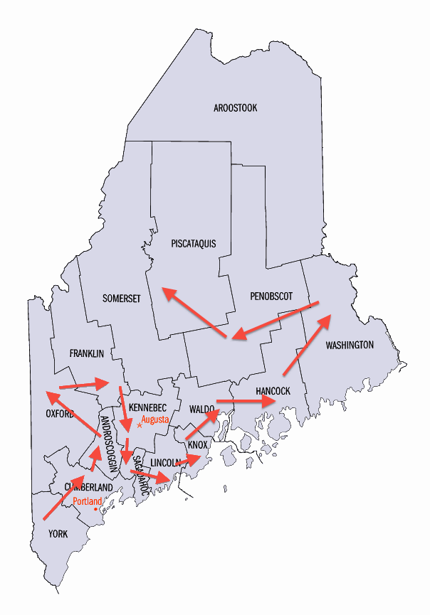
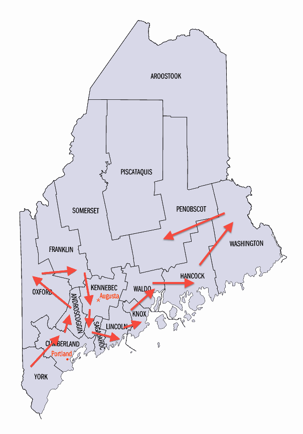
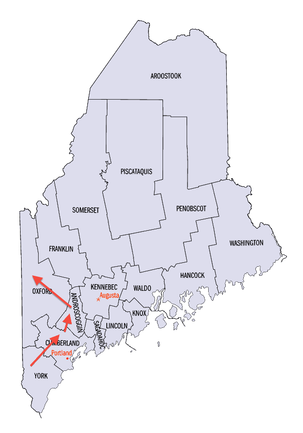
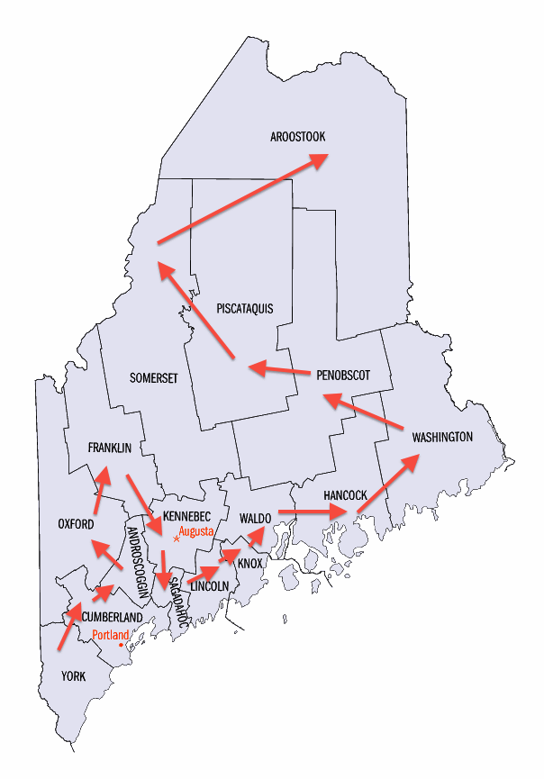
Aroostook County (pop. 71,870), the northernmost county in Maine, makes up about one-fifth of the state. Known locally as “The County,” it is the largest county in any state east of Minnesota.

It borders Quebec and New Brunswick.

Aroostook (pronounced “ah-ROO-stick”) is a Native American word meaning “beautiful river.” In the St. John River Valley, in the northern end of the county, many residents speak both French and English.

The river separates Maine from New Brunswick.

The town of Fort Kent (pop. 6,123), on the St. John River, has a campus of the University of Maine. It was founded in 1878 as a teachers’ school.

It has about 1,000 students.

The Fort Kent State Historic Site commemorates the Aroostook War (1838-39), a border dispute between the U.S. and Canada that involved no actual combat.

The blockhouse at Fort Kent

Fort Kent is the northern terminus of U.S. Highway 1, which goes 2,369 miles to Key West, Florida.

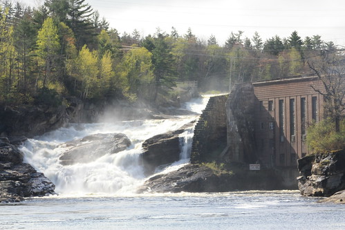
The western part of Aroostook County includes the Allagash Wilderness Waterway, a 92-mile-long protected area of rivers, lakes, and streams in the Maine North Woods.

The Allagash River

Most of Aroostook’s residents live in the eastern part of the county, where Presque Isle (pop. 9,692), Caribou (pop. 8,189), and Fort Fairfield (pop. 3,496) are located. The area is the leading potato-growing region in the eastern U.S.

Fort Fairfield is the home of the annual Maine Potato Blossom Festival.

The festival always includes a parade.

Presque Isle (meaning “peninsula” in French), the largest city in Aroostook County, was named for the peninsula formed by the Aroostook River and Presque Isle Stream.

The University of Maine also has a campus there.

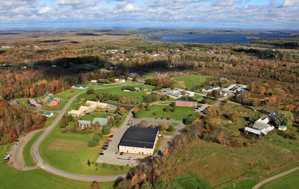
North of Fort Fairfield is the town of Limestone (pop. 2,314). Its population was almost 10,000 in the days before Loring Air Force Base closed in 1994.

It was the largest base for the Strategic Air Command.

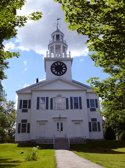
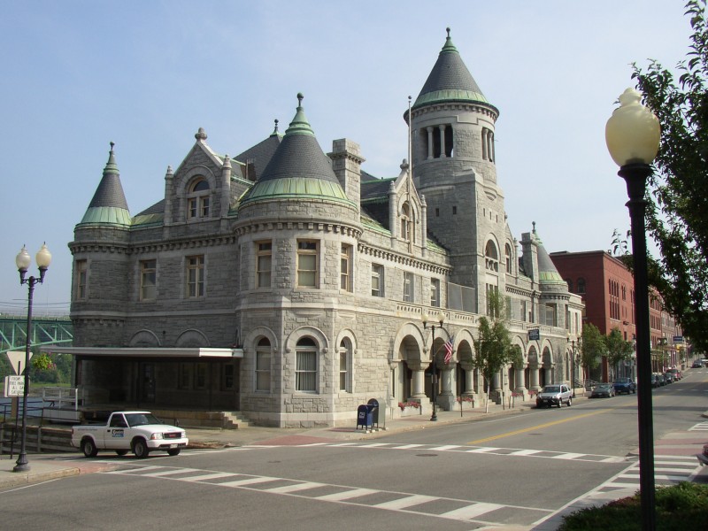
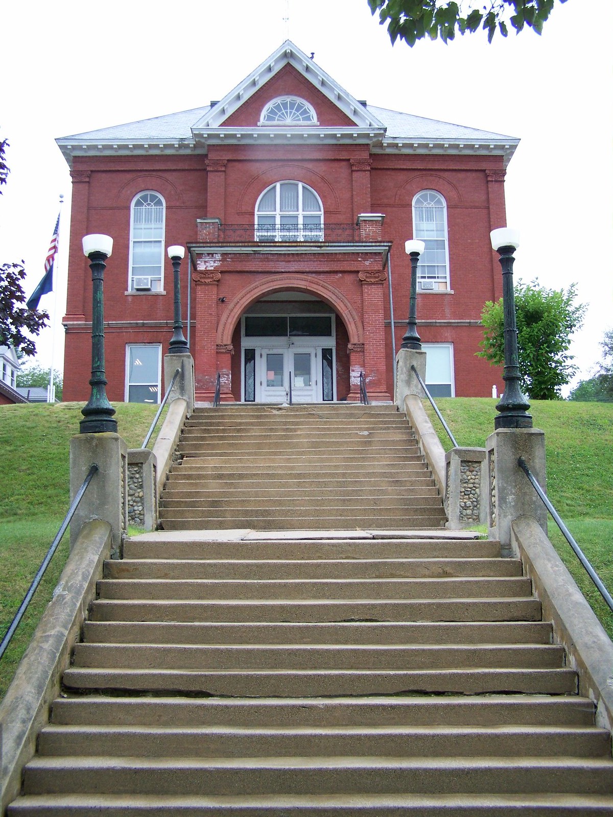
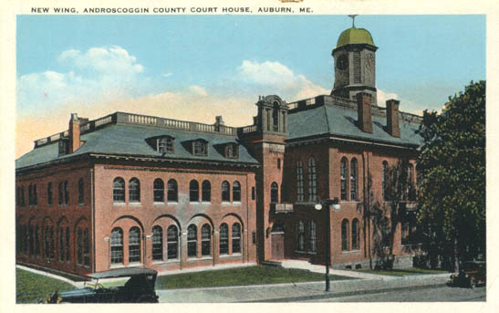
The county seat of Aroostook County is Houlton (pop. 6,123), located in the southeastern part of the county.

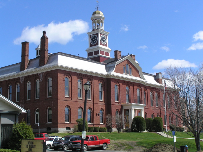
Aroostook County Courthouse (1859)

Houlton’s nickname is “Shire Town,” and the Houlton High School athletic teams are called the Shiretowners.

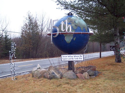
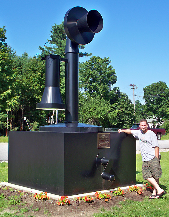
The Maine Solar System Model extends about 42 miles (north to south) along Highway 1, beginning with the sun on the University of Maine campus in Presque Isle and ending at Pluto in Houlton.

Saturn is near the town of Westfield.

NEXT STATE: MICHIGAN (coming soon)

Maine: Somerset County

Somerset County (pop. 52,228) is Maine’s third-largest county in square miles. It was named for Somerset County, England. The states of Maryland, New Jersey, and Pennsylvania also have Somerset counties.

The county shares a long border with Quebec. U.S. Highway 201 in the county is officially known as the Old Canada Road National Scenic Byway.

The county seat of Somerset County is Skowhegan (pop. 8,589). The name comes from an Indian word meaning “gathering place.”

On the Kennebec River

Margaret Chase Smith (1897-1995), U.S. senator from Maine from 1949 to 1973, was born in Skowhegan. She was Maine’s first female senator.

A moderate Republican

“The World’s Tallest Indian” is a 62-foot sculpture (with a 20-foot base) in downtown Skowhegan. It was built in 1969.

Now undergoing restoration

The Skowhegan State Fair calls itself “The Nation’s Oldest Consecutively Running Agricultural Fair.” It began in 1818 and has been running for 195 years.

Just west of Skowhegan is Madison (pop. 4,855), home of Backyard Farms, which has a 42-acre greenhouse (about the size of 30 football fields) growing vine-ripened tomatoes.

The state’s largest building

The town of New Portland (pop. 718) is known for the Wire Suspension Bridge, built in 1866 across the Carrabassett River.

Probably the last of its kind

NEXTY: AROOSTOOK COUNTY

maine map - working copy copy

Maine: Piscataquis County

Piscataquis County (pop. 17,535) is the least populous county in Maine, and the second-largest in square miles. The county reached its peak population of 20,554 in 1920. It is pronounced “Pis-KAT-uh-kwis.”

Piscataquis County in 1895

“Piscataquis” is an Abenaki word meaning “branch of the river.” The 65-mile Piscataquis River is a major tributary of the Penobscot River.

It flows through the southern part of the county.

Piscataquis County has been called the most rural county in the most rural state in the U.S. The county is mostly unsettled wilderness, with much land traditionally owned by the timber industry.

Most of the population is in the county’s southernmost part.

The county seat is Dover-Foxcroft (pop. 4,213). The two communities, located on opposite sides of the Piscataquis River, merged in 1922.

It is also the county’s largest town.

Northwest of Dover-Foxcroft is the town of Monson (pop. 686), a major resting point on the 2,200-mile Appalachian Trail.

The trail goes from Georgia to Maine.

Monson is the last town before the trail goes east into the “Hundred-Mile Wilderness,” which is often considered the wildest area of the trail.

The Appalachian Trail ends on Mount Katahdin (elev. 5,269), the highest point in Maine.

The mountain is in Baxter State Park.

Baxter State Park is unusual in several ways: it has no electricity, running water, or paved roads, and it’s not actually part of the Maine State Park System.

Piscataquis County has many large lakes and reservoirs, with abundant fishing. Moosehead Lake is the largest mountain lake in the eastern U.S.

The source of the Kennebec River

NEXT: SOMERSET COUNTY

maine map - working copy copy

Maine: Penobscot County

Penobscot County (pop. 153,923) is Maine’s third-largest county in population. Most of the northern part of this odd-shaped county is wilderness, and the southern part is the urban area around the city of Bangor.

Bangor (pop. 33,039) is the county seat of Penobscot County and the third-largest city in Maine.

It’s 30 miles up the Penobscot River from Penobscot Bay.

Much of Bangor was rebuilt after the Great Fire of 1911 destroyed hundreds of commerical and residential buildings.

The Bangor Public Library opened in 1913.

The Bangor Opera House dates from 1920. The Penobscot Theatre Company – which calls itself the northeasternmost theater company in the U.S. – presents a regular season of live plays in the theater.

It was a movie house for many years.

Author Stephen King lives in the Bangor area; the Greater Bangor Convention and Visitors Bureau offers regular “Tommyknockers and More” bus tours of locations from King’s books.

The King home

Bangor (as well as places in Minnesota) claims to be the birthplace of Paul Bunyan. A 31-foot statue of Paul is in Bass Park.

Constructed in 1959

In the town of Orono (pop. 10,362) is the flagship campus of the University of Maine. It was founded in 1868 as Maine State College. Today, it has about 11,000 students.

On the Penobscot River

The Penobscot Indian Island Reservation is north of Orono, along the Penobscot River. The Penobscot Tribe is headquartered on Indian Island.

The town of Corinna (pop. 2,198) is the home of the Stewart Free Library, a gift to the town from Minneapolis millionaire Levi M. Stewart.

Built in 1898

NEXT: PISCATAQUIS COUNTY

maine map - working copy copy

Maine: Washington County

Washington County (pop. 32,856) is one of 30 Washington counties (plus one Washington parish) in the U.S. Its population is less now than it was in 1850.

Adjacent to New Brunswick

Washington County is Maine’s third-smallest in population. Its county seat, Machias (Much-EYE-us), is Maine’s smallest county seat, with a population of 2,221.

Centre Street Congregational Church

The University of Maine has a campus in Machias. It was established in 1909 as the Washington State Normal School.

It has about 1,000 students.

Washington County is sometimes referred to as “Sunrise County” because it is the easternmost county in the continental United States. The town of Lubec (pop. 1,359) is at the easternmost point of all.

West Quoddy Head Light, Lubec (1858)

Near Lubec is the small city of Eastport (pop. 1,331), which is located entirely on islands.

Eastport’s Big Fisherman

Much of Washington County’s economy depends on fishing and on blueberry production. The town of Cherryfield (pop. 1,232) calls itself “The Blueberry Capital of the World.”

Hammonton, N.J., also claims this title.

“The World’s Largest Blueberry” is a few miles away in the town of Columbia Falls (pop. 560).

At Wild Blueberry Land

The town of Perry (pop. 889) is the home of the 45th Parallel Gift Shop, located near the line of latitude that is about halfway between the Equator and the North Pole.

A variety of 45th-parallel gifts are available.

NEXT: PENOBSCOT COUNTY

maine map - working copy copy

Maine: Hancock County

Hancock County (pop. 54,418) is one of 10 Hancock counties – all named for John Hancock (1737-1793), the early American patriot who is best known today for his signature on the Declaration of Independence.

Hancock County has the longest coastline of any county in Maine. Its economy depends mostly on fishing and tourism – much of the tourism being at Acadia National Park, the first national park located east of the Mississippi River (1919).

It was originally called Lafayette National Park.

Most of Acadia is on Mount Desert Island. Mount Desert is the second-largest island on the east coast of the U.S. (after Long  Island).

Cadillac Mountain (elev. 1,528), on Mount Desert Island, is the highest point in the U.S. within 25 miles of the Atlantic coast.

The view from Cadillac Mountain

Many wealthy and influential Americans such as John D. Rockefeller, Jr., J.P. Morgan, Cornelius Vanderbilt, and the Astor family have had homes in Bar Harbor (pop. 5,235), on the east side of Mount Desert Island.

Many cruise ships now visit Bar Harbor.

The county seat of Hancock County is the city of Ellsworth (pop. 7,741), located a few miles inland from Mount Desert Island.

The Great Fire of 1933 destroyed most of Ellsworth’s downtown and many homes.

City Hall was built after the fire.

The Grand is a former movie theater in downtown Ellsworth that opened in 1938. It’s now a performing arts center for the community.

Concerts, plays, and movies

In the town of Hancock (pop. 2,394) is a large fiberglass lobster, available for photo opportunities.

His name is Wilbur.

Author E.B. White (1899-1985) lived for many years in the town of Brooklin (pop. 824).

NEXT: WASHINGTON COUNTY

maine map - working copy copy

Maine: Waldo County

Waldo County (pop. 38,786) is between Knox and Hancock counties, along the Atlantic coast. It was named for Samuel Waldo (1696-1759), a native of Boston who was involved in the early settlement of Maine.

The county seat of Waldo County is Belfast (pop. 6,668).  Over the years, Belfast has been a center of shipbuilding, seafood processing, and poultry processing – and it is now well-known by tourists for its 19th-century architecture.

Downtown Belfast

Belfast is located at the mouth of the Passagassawakeag River estuary on Penobscot Bay. The river’s source is 16 miles away in Lake Passagassawakeag.

Pronounced “pas-uh-gas-uh-WAH-keg”

The First Church of Belfast dates from 1818.

United Church of Christ

The Colonial Theatre in Belfast was built in 1924. It shows a variety of first-run, independent, and foreign films.

It has an elephant on the roof.

Perry’s Nut House has been a roadside attraction in Belfast since 1927.

The town of Searsport (pop. 2,615) calls itself the Antique Capital of Maine.

Penobscot Marine Museum, Searsport

In the town of Prospect (pop. 709) are Fort Knox, dating from 1844, and the Penobscot Narrows Bridge (over the Penobscot River to Verona Island), built in 2006.

Fort Knox and Penobscot Narrows Bridge

The town of Unity (pop. 2,099) is the home of Unity College, which opened in 1965. Its curriculum focuses on the environment and natural resources.

It has about 500 students.

NEXT: HANCOCK COUNTY

maine map - working copy copy

Maine: Knox County

Knox County (pop. 39,736) is one of nine Knox counties – all named for Henry Knox (1750-1806), the first U.S. secretary of war.

The coast and islands of Knox County have been popular as summer homes for wealthy residents of the Northeast for more than a century.

The county seat of Knox County is Rockland (pop. 7,297).

Strand Theatre, Rockland (1923)

The Maine State Ferry Service operates ferries from Rockland to the islands of Vinalhaven, North Haven, and Matinicus.

Rockland hosts the Maine Lobster Festival every August; this year was the 66th festival.

The five-day festival includes a parade on Saturday,

The Maine Eastern Railroad runs 57 miles from Rockland to Brunswick, with freight service year-round and passenger service seasonally,

The special “Lobster City Express” runs during the festival.

Artist Andrew Wyeth (1917-2009) made his summer home in the town of Cushing (pop. 1,534). His paintings of the Olson House in Cushing include “Christina’s World” (1948).

The house is now open as a museum.

Knox County’s many scenic lighthouses include Owls Head Light, built in 1826.

At the entrance of Rockland Harbor

The Maine State Prison Showroom in Thomaston (pop. 2,781) sells a variety of items made by inmates in the state’s prisons.

A nice selection of handmade clocks

The U.S. National Toboggan Championships are held annually in Camden (pop. 4,850). The 400-foot chute ends on a frozen pond.

Speeds of up to 40 mph

In the town of Rockport (pop. 3,330), a small monument commemorates the birthplace of the inventor of the doughnut hole.

Margaret Wise Brown (1910-1952), author of many books for children, had a home on Vinalhaven Island.

She published “Goodnight Moon” in 1947.

NEXT: WALDO COUNTY

maine map - working copy copy

Maine: Lincoln County

Lincoln County  (pop. 34,457) is on the Atlantic coast of Maine, just east of Sagadahoc County. It is the state’s third-smallest county in square miles.

When founded in 1760, it covered three-fifths of Maine.

It is one of 23 Lincoln counties in the U.S., and it’s one of several that were not named for Abraham Lincoln.

It was named for Lincoln, England.

With 451 miles of coastline, Lincoln County is a popular area for summer tourism.

Pemaquid Point Light (1835)

The county seat of Lincoln County is Wiscasset (pop. 3,732), the state’s third-smallest county seat.

Castle Tucker is a mansion built in 1807, when Wiscasset was at the peak of its prosperity as a port. It is now a museum.

Built in the Regency style

Red’s Eats is a legendary take-out restaurant in Wiscasset. It’s been at the same location since 1954.

Long lines for lobster rolls and fried clams

The town of Waldoboro (pop. 5,075) is the home of Fawcett’s Antique Toy and Art Museum

The building was originally Aunt Lydia’s Tavern.

Monhegan Island, 12 miles off the coast, has a population of about 65.

And no cars

In Newcastle (pop. 1,752), St. Patrick Church (1807) is the oldest Catholic church in New England.

Part of All Saints Parish

The coastal town of Boothbay Harbor (pop. 2,165) has a lighthouse called Cuckolds Light (1907) and a giant statue of an old fisherman.

Wearing a yellow raincoat

Parts of the 1956 musical “Carousel” were filmed in Boothbay Harbor.

Shirley Jones and Gordon MacRae

NEXT: KNOX COUNTY

maine map - working copy copy

Maine: Sagadahoc County

Sagadahoc County (pop. 35,293) is Maine’s smallest county in square miles. The name comes from an Indian word meaning “mouth of big river” – the river being the Kennebec.

The stress is on the first syllable.

Merrymeeting Bay, in the middle of the county, is an unusual freshwater tidal bay. Six rivers flow into it, draining almost 40 percent of Maine.

It’s about 17 miles from the Atlantic Ocean.

Georgetown Island (pop. 1,042) is reached by bridge from the mainland.

A popular area for tourists

The county seat of Sagadahoc County is Bath (pop. 8,514), whose nickname is “City of Ships.”

Bath City Hall (1929)

Bath was named for Bath, England, from which many of the early settlers immigrated.

Royal Crescent, Bath

Bath, Maine, is known for its 19th-century architecture, including the Winter Street Church (1843).

Now the Winter Street Center

Topsham (pop. 8,784) is the largest town in Sagadahoc County. It was named for a town near Exeter in the county of Devon, England.

Pejepscot Paper Co. Mill in Topsham (1868)

The town of Phippsburg (pop. 2,216) is the home of two old forts built for coastal defense – Fort Popham (1861) and Fort Baldwin (1905).

Remains of Fort Baldwin

On the Kennebec River in Arrowsic (pop. 427) is the now-defunct Fiddler’s Reach Fog Signal, built in 1914.

Erected after a steamboat ran aground there

NEXT: LINCOLN COUNTY

maine map - working copy copy

Maine: Kennebec County

Kennebec County (pop. 122,151) is southeast of Franklin County. “Kennebec” is an Eastern Abenaki word meaning “large body of still water.”

The county was traditionally a center of industry, with paper and textile mills along the 170-mile Kennebec River.

Kennebec River at Augusta

Augusta (pop. 19,136) is the county seat of Kennebec County and the capital of Maine. Augusta is the third-smallest state capital – after Montpelier, Vermont, and Pierre, South Dakota.

The Maine State House was built in 1832.

The University of Maine at Augusta, established in 1965, has about 5,000 students.

The Moose is the school’s mascot.

The Kennebec County Courthouse was built in 1830.

With additions in 1851 and 1907

The “Olde Federal Building” in Augusta served as the city’s main post office until the 1960s.

Built in 1890

The Kennebec Arsenal is a historic district in Augusta dating from the 19th century; it has been empty and awaiting renovation for several years.

The state housed mental patients there for many years.

The city of Waterville (pop. 15,722) is the home of Colby College, a private liberal arts college that was founded in 1813.

It has about 1,800 students.

Waterville also has the “Two-Cent Bridge,” a suspension footbridge over the Kennebec River which formerly had a toll of two cents. It dates from 1903.

The charge was abolished in 1960.

The 25-foot Ladies Delight Lighthouse on Lake Cobbosseecontee has been preventing boats from running aground since 1908.

Located on Ladies Delight Island

Poet Edward Arlington Robinson grew up in the town of Gardiner (pop. now 5,800).

Immortalized by Simon and Garfunkel

NEXT: SAGADAHOC COUNTY

maine map - working copy copy

Maine: Franklin County

Franklin County (pop. 30,768) is east of Oxford County. It is one of 24 Franklin counties (and one Franklin Parish) in the U.S.

The county seat of Franklin County is Farmington (pop. 7,760). Farmington is known as the “Birthplace of Earmuffs” because it was the hometown of earmuff inventor Chester Greenwood (1858-1937).

Farmington has an annual Chester Greenwood Day.

The Franklin County Courthouse was built in 1885.

Romanesque Revival style

The University of Maine at Farmington is a public liberal arts college. Founded in 1864 as Western State Normal School, it was the state’s first public institution of higher education.

It has about 2,300 students.

Franklin County has several ski areas. Sugarloaf is the largest ski area east of the Mississippi River, in terms of the number of trails and skiable area.

Sugarloaf Mountain (4,237 feet) is Maine’s second-highest point.

Mount Blue State Park is near the town of Weld (pop. 419).

Webb Lake and Mount Blue

The town of Strong (pop. 1,213) was once known as the “Toothpick Capital of the World.”

The town of Kingfield (pop 997) is the home of the Herbert Grand Hotel, built in 1918.

Near Sugarloaf Mountain

The 42-mile Dead River flows from Flagstaff Lake to join the Kennebec River.

New footbridge over Dead River

NEXT: KENNEBEC COUNTY

maine map - working copy copy

Maine: Oxford County

Oxford County (pop. 57,833) borders New Hampshire on the west and Quebec on the north. It’s the only Oxford County in the U.S.; Ontario and New Zealand also have Oxford counties.

Oxford County is known for its scenic covered bridges and summer camps. Wyonegonic Camp for Girls (1902) is the nation’s oldest continuously operated girls’ camp.

Artist’s Bridge (1872)

Oxford County has towns named Denmark, Mexico, Norway, Peru, and Sweden.

Norway (pop. 5,104) was once known as “The Snowshoe Capital of the World” because of the many snowshoes manufactured there.

Lake Pennesseewassee

The county seat of Oxford County is the town of Paris (pop. 5,183). The courthouse and commercial district are within the census-designated place of South Paris, which is within the town boundary of Paris.

Oxford County Courthouse (1895)

The Village of Bryant Pond had the last hand-crank telephone exchange in the U.S. (until 1983). In commemoration, Bryant Pond now has a 3,000-pound telephone sculpture on display.

14 feet tall

Ski resorts in Oxford County include Sunday River (1959) and Black Mountain of Maine (1962).

Sunday River has a vertical drop of 2,340 feet.

The town of Rumford (pop. 5,841) has been known for its paper industry since the late 19th century.  Pennacook Falls is on the Androscoggin River in Rumford.

Vertical drop of 176 feet

Edmund Muskie (1914-1996) was born in Rumford. He was governor of Maine, senator from Maine, and secretary of state under President Jimmy Carter.

Vice-presidential candidate (right) with Hubert Humphrey in 1968

The town of Fryeburg (pop. 3,449) hosts the annual Fryeburg Fair – Maine’s largest agricultural fair.

More than 300,000 visitors annually

NEXT: FRANKLIN COUNTY

maine map - working copy copy

Maine: Androscoggin County

Androscoggin County (pop. 107,702), northeast of Cumberland County, was named for the Androscoggin River. “Androscoggin” comes from a Native American word meaning  “river of rock shelters.”

The county seat of Androscoggin County is Auburn (pop. 23,055), which was a center of shoe manufacturing from the late 1800s until the 1950s.

Androscoggin County Courthouse (1857)

The Charles A. Jordan House in Auburn dates from 1880.

Second Empire style

The Barker Mill (1873) in Auburn was turned into apartments for senior citizens in 1979.

Now the Barker Mill Arms

Auburn is across the Androscoggin River from its “twin city” of Lewiston (pop. 36,592), largest city in the county.

Actor Patrick Dempsey was born in Lewiston.

Lewiston is the home of Bates College, a private liberal arts college founded in 1855 by abolitionists.

It was coeducational from the start.

The Bates Mill, a textile factory in Lewiston, was Maine’s largest employer for many years. Today, the complex has offices, restaurants, and a museum.

It produced textiles for the Union Army in the Civil War.

The Basilica of Saints Peter and Paul was built in 1936.

Second-largest church in New England

Lewiston’s City Hall was built in 1892.

The spire is 185 feet high.

The town of Poland (pop. 5,376) was the home of the Poland Spring House, a well-known resort.

It burned down in 1975.

Lisbon Falls (pop. 4,100) is where author Stephen King went to high school. The annual Moxie Festival in Lisbon Falls celebrates the carbonated beverage known as Moxie.

The official soft drink of Maine

The “Androscoggin Creature” was an unidentified animal that was hit by a car and killed in the county in 2006.

Doglike

NEXT: OXFORD COUNTY

maine map - working copy copy

Maine: Cumberland County

Cumberland County (pop. 281,674) is Maine’s most populous county. It was named for William, Duke of Cumberland, son of King George II.

The U.S. has nine Cumberland counties.

Cumberland County is just northeast of York County. Much of it is along Casco Bay, an inlet of the Gulf of Maine.

Sebago Lake, Maine’s second-largest lake, is popular for fishing, boating, and camping.

Portland (pop.66,214) is the county seat of Cumberland County and the largest city in Maine.

Portland City Hall (1909)

The poet Henry Wadsworth Longfellow (1807-1882) was born in Portland.

Longfellow statue in Portland

John Ford (1894-1973), legendary director of film westerns,  grew up in Portland and played football at Portland High School.

John Ford in Monument Valley

The Port of Portland is a major seaport on the Atlantic Coast. Ferry services run from the port to several outlying islands.

Old Port, Portland

Portland is home of the International Cryptozoology Museum, with exhibits on animals whose existence has not been proven.

Bigfoot model on display

The Portland Sea Dogs, Double-A Eastern League affiliate of the Boston Red Sox, play at Hadlock Field in Portland.

“Maine Monster” wall in left field

Northeast of Portland is Freeport (pop. 7,979), home of L.L. Bean.

The store is open 24 hours a day.

The landscape painter Winslow Homer (1836-1910) had his studio in the town of Scarborough (pop. 18,919) for many years. The studio is now open for tours.

“The Gulf Stream”

Yarmouth (pop. 8,349) is the home of “The World’s Largest Rotating Globe,” located at the headquarters of the DeLorme company, a maker of mapping and GPS products.

Its nickname is “Eartha.”

The town of Brunswick (pop. 20,278) is the northern terminus of Amtrak’s “Downeaster” train, which runs 141 miles to North Station in Boston.

Also the home of Bowdoin College

NEXT: ANDROSCOGGIN COUNTY

maine map - working copy copy

Maine: York County

We begin our tour of Maine’s 16 counties in York County, located at the southern tip of the state. This is the route that we’ll be taking:

maine map - complete copy

One of five York counties in the U.S.

York County (pop. 197,131) has the second-largest population in Maine, but its county seat of Alfred (pop. 3,019) is the state’s second-smallest county seat.

York County Courthouse

Alfred is inland, but most of York County’s population is along the Atlantic Ocean and the Interstate 95 corridor that parallels the coast.

The town of Kittery (pop. 9,490) is across Portsmouth Harbor from the city of Portsmouth, N.H. The Portsmouth Naval Shipyard is actually in Kittery.

Submarines are remodeled and repaired there.

Southeast of Kittery – closer to New Hampshire than to Maine – are the Isles of Shoals. About half of these small islands are in Maine, and about half are in New Hampshire.

Smuttynose Island is in Maine.

A few miles up the coast, in the town of York (pop. 12,529), is the Wiggly Bridge.

Known as “The World’s Smallest Suspension Bridge”

The Ogunquit Playhouse in Ogunquit (pop. 1,429) has been putting on a summer season of plays since 1933.

In Kennebunk (pop. 10,798) and other York County communities is the Rachel Carson National Wildlife Refuge, which protects a variety of habitats including dunes, estuaries, and rocky coastline.

More than 5,000 acres

Kennebunkport (pop. 3,474) is the home of the Seashore Trolley Museum, which calls itself the world’s oldest and largest collection of mass transit vehicles.

More than 260 vehicles

The Bush family has had a family retreat in Kennebunkport for more than a century.

Summer home of the first President Bush.

Biddeford (pop. 21,277) is the largest city in York County. The private University of New England is in Biddeford.

Where the Saco River flows into the Atlantic

York County has many miles of Atlantic Ocean beaches. Old Orchard Beach (pop. 8,624) has a seven-mile beach.

Pier at Old Orchard Beach

NEXT: CUMBERLAND COUNTY

maine map - working copy